Sary Jaz Valley
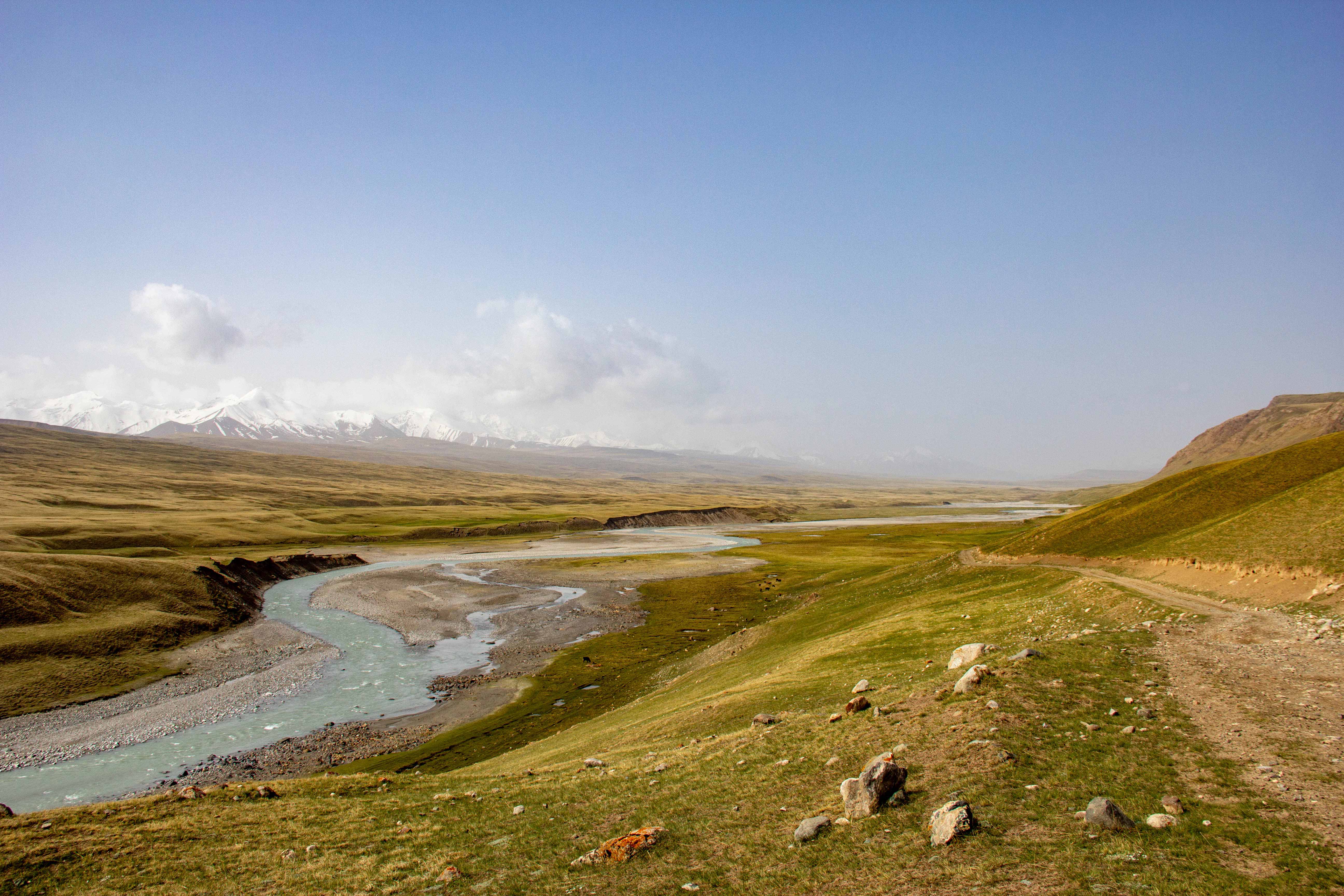
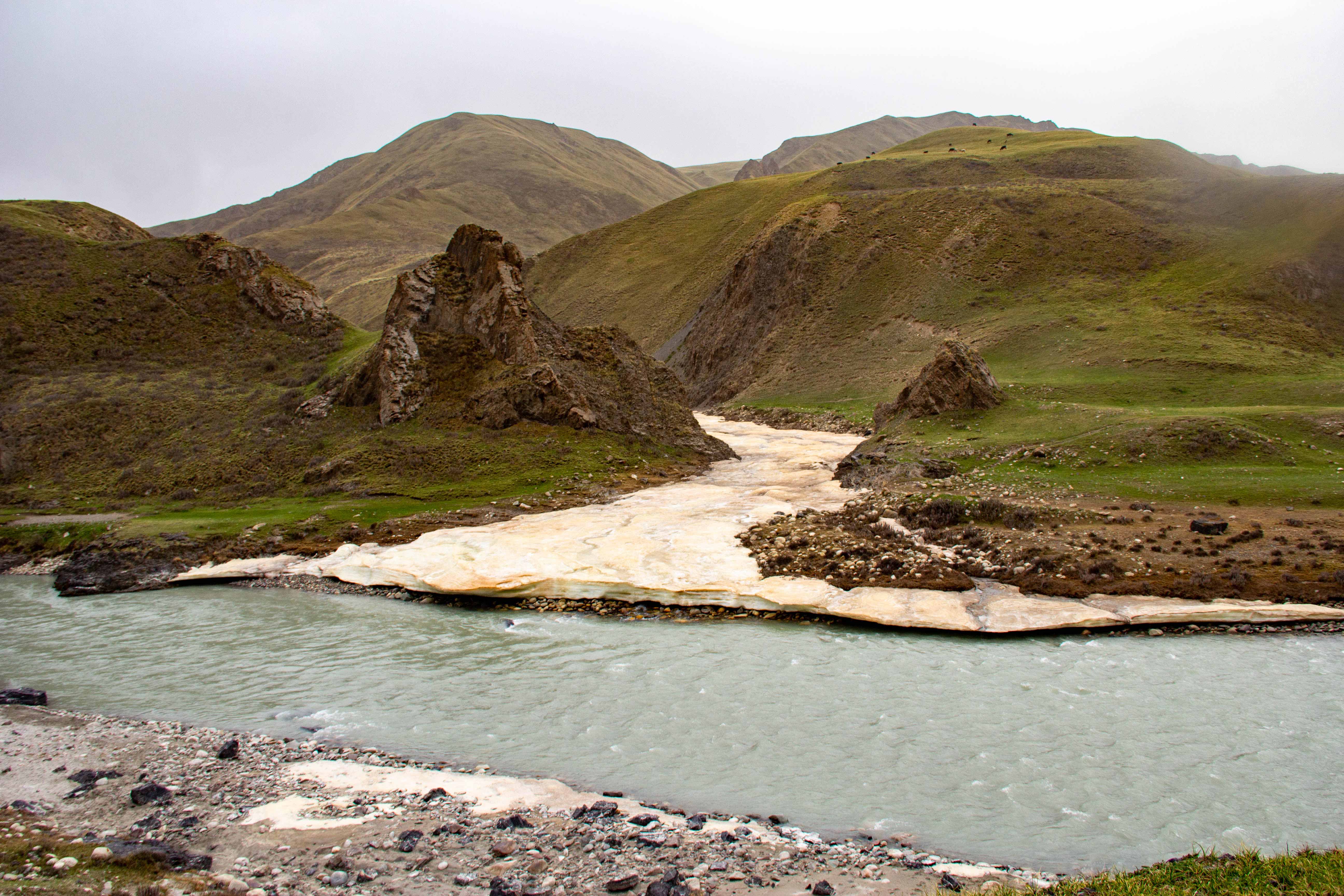
The Sary-Jaz Valley is nestled in the gorge of the river bearing the same name and its right tributary, the Ak-Shyrak, in the foothills of the Central Tien Shan, spanning altitudes from 2700 to 3500 meters above sea level. The river initially meanders through the sirts (summer pastures), running parallel to the Sary-Jaz Range on the northern side.
Sary-Jaz is one of the largest mountain rivers in the region, stretching for 198 km. Fed by the melting waters of the snow and glaciers of the mighty Muzdag mountain range, this watercourse flows majestically through the landscape.
Journeying through the Sary-Jaz Valley unveils magnificent views of mountain ridges, sharp peaks, and cirques surrounding the ranges. On the horizon, mountains are blanketed with a thick layer of snow, revealing shimmering tongues of glaciers. Under favorable conditions, the sunset may reveal the pinnacle of Mount Hantengri (7010 m).
The Sary-Jaz Valley cuts through the formidable Kakshaal-Too Range, heading towards China.
The vegetation in the valley has adapted to harsh conditions. At an altitude of around 3000 meters, the high-mountain steppe belt gives way to a landscape dominated by tianshan fir, wormwood, and fescue.
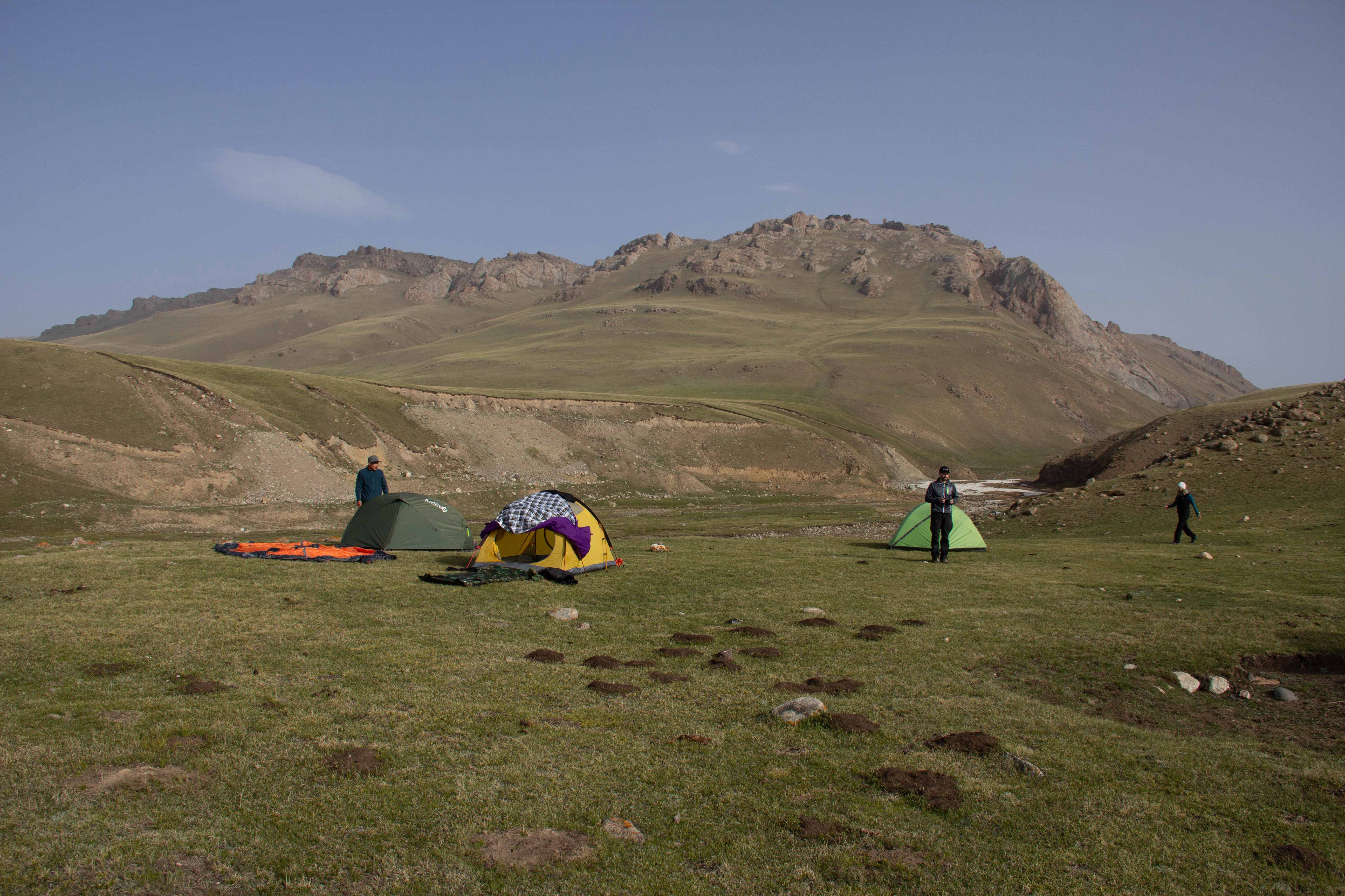
This region holds tremendous potential for organizing extreme rafting, as well as car and motorcycle tourism, cycling, and equestrian and hiking tours.
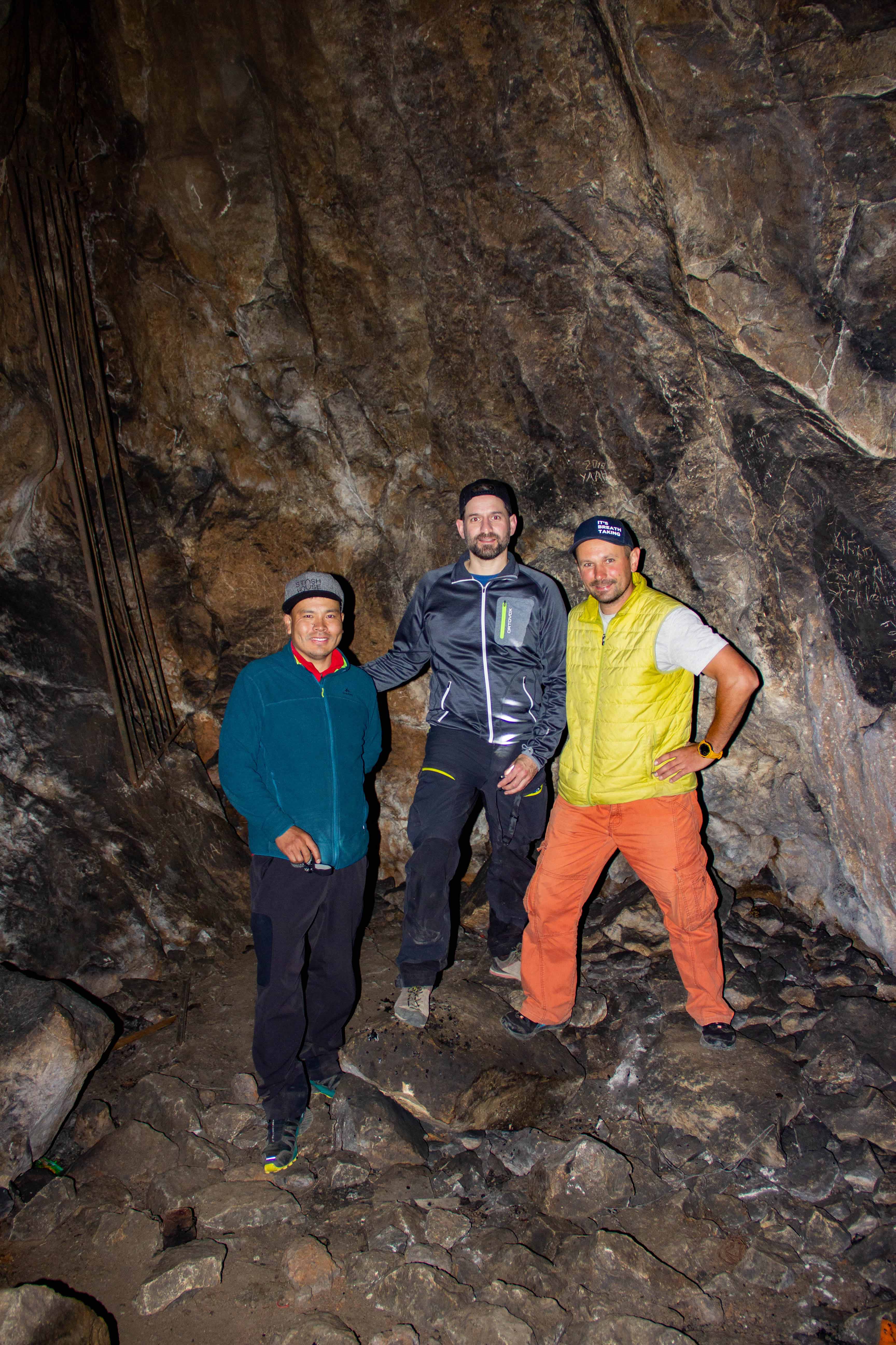
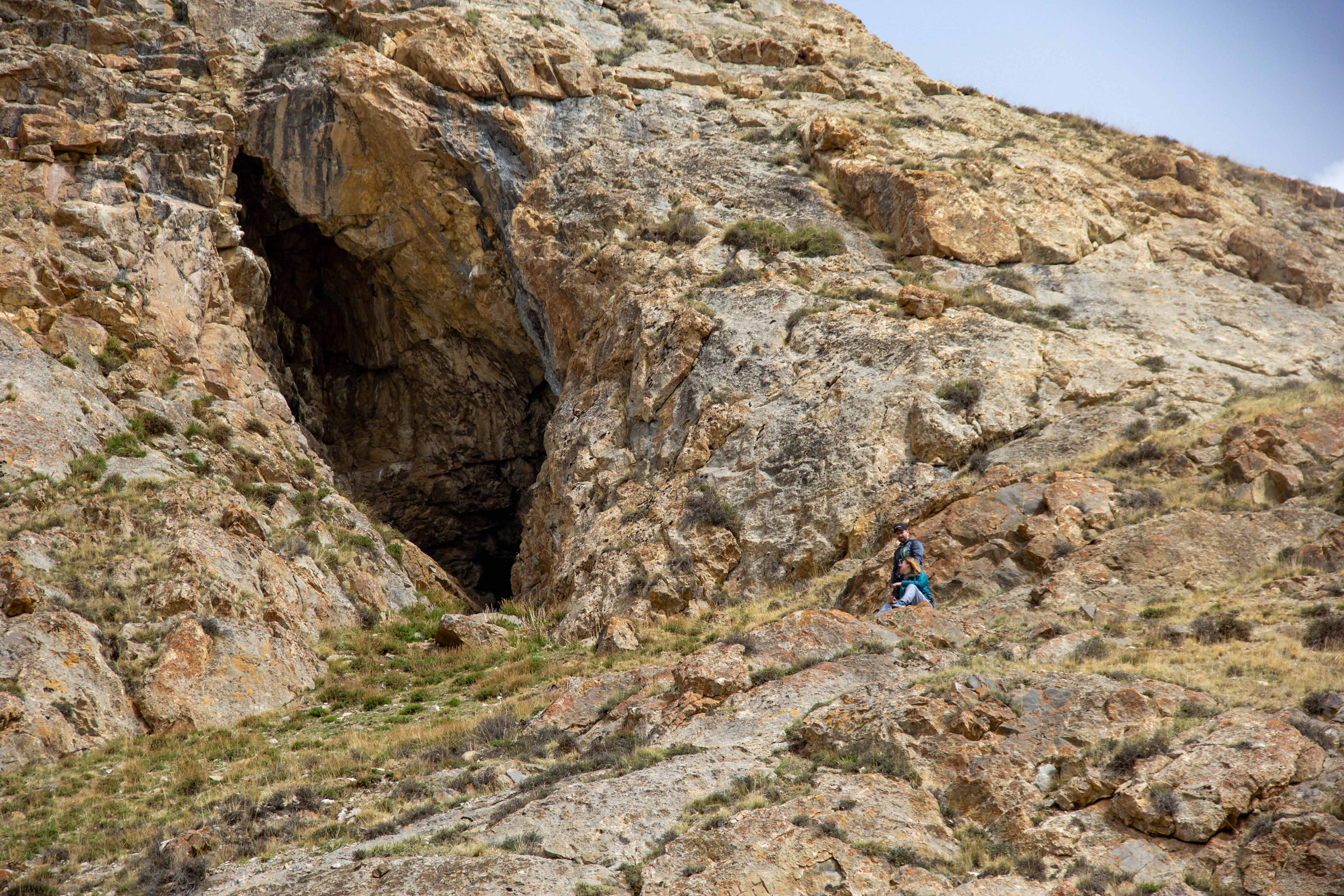
Traveling through the Sary-Jaz Valley promises encounters with many wonders. From visiting the picturesque Sary-Jaz Canyon to exploring the Ak-Chunkur Cave, known as the “white pit,” with its ancient history, and a small lake nearby.
To book a tour to this unique destination, feel free to contact us.
Долина Сары-Джаз
Долина Сары-Джаз расположена в ущелье одноименной реки и ее правого притока Ак-Шийрак в предгорьях Центрального Тянь-Шаня, простираясь на высотах от 2700 до 3500 метров над уровнем моря. Река мчится через сырта (летние пастбища) параллельно хребту Сары-Джаз с северной стороны.
Сары-Джаз — одна из величайших горных рек в регионе, протяженность ее составляет 198 км. Эта водная артерия питается талыми водами снегов и ледников могучего горного массива Муздаг и восхитительно течет сквозь местность.
Путешествие по долине Сары-Джаз откроет вам величественные виды на горные гребни, острые вершины и цирки окружающих хребтов. Здесь, на горизонте, горы увиты мощной снежной пеленой, под которой просматриваются сверкающие языки ледников. При благоприятных условиях на закате вы можете увидеть вершину пика Хантенгри (7010 м).
Долина Сары-Джаз прорезает мощный хребет Какшаал-Тоо, направляясь в сторону Китая.
Растительность в долине адаптировалась к суровым условиям, где на высоте около 3000 м заканчивается граница высокогорного степного пояса, а вместо него процветают типчак, полынь и ковыль.
Эта местность обладает огромным потенциалом для организации экстремального рафтинга, авто- и мото-туризма, велопутешествий, а также для конных и пеших прогулок.
Путешествие по долине Сары-Джаз обещает вам увидеть много удивительного. От посещения живописного Сары-Джазского каньона до исследования пещеры Ак-Чункур “белая яма” с древней историей и небольшого озера в ее окрестностях.
Для заказа тура по этому уникальному направлению, свяжитесь с нами.